The modern world runs on signals most people never see.
GPS, the world’s position system, now guides trucks, times financial trades, routes ambulances, and keeps supply chains moving. It works so well that no one questions it. That, according to TERN.ai CEO Shaun Moore, is the problem.
“You know, more often than not, people would ask the question, why go back to just GPS? With TERN, you’re not having the issues that you were having with GPS, whether it be in a downtown city like New York, or in a tunnel or a parking garage. TERN lets you get in your car and fire it up, and in 10 seconds it figures out where you are.”
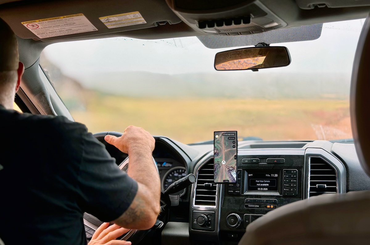
Moore and the team at TERN, the starting point was simple and uncomfortable. What if that signal disappears? TERN’s core system, called an Independently Derived Positioning System, is built on a blunt assumption: GPS will fail. Not maybe, not someday, but in any serious conflict or disruption scenario. The system ignores satellites entirely and instead uses what already exists on the vehicle: speed, engine load, trajectory, and combines it with map data to produce location in real time. It outputs latitude and longitude continuously, without waiting for a signal from space.
That design choice reflects a shift in how the future is being defined by uncertainty. The old model focused on backup systems. The new model assumes failure and builds around it.
For decades, the United States and its allies treated GPS as a given. It was free, global, and reliable. That made it a single point of failure. Executive Order 13905 recognized this risk and called for resilience in “position, navigation, and timing systems.” TERN’s approach fits into a broader pattern emerging across defense and critical infrastructure. Instead of building taller walls around fragile systems, companies are building parallel capabilities that do not share the same weaknesses.
GPS denial is already happening. In Ukraine, signal disruption has become routine. Jamming has been reported across the Middle East and parts of South America. In those environments, systems that depend on satellites degrade quickly or fail outright.
“Ukraine has been living with jamming now for a number of years where they’ve been in total denial in some scenarios. We’ve seen it now over in Iran. They’ve been actively jamming over there, and I think they even came out and said they were jamming the Starlink satellites. We’ve seen it down in South America. We’ve seen it in Israel. So I think the last two or three years, the expectation now is that GPS will not be available in any future conflict,” he said.
The company recently announced a partnership with Sandtable, a mapping and mission planning tool that gives TERN a complete environmental map of its surroundings. Their system compresses large terrain datasets into something usable in real time, allowing operators to simulate and plan movement across complex environments.
When combined with TERN’s positioning system, the result is a closed loop. Planning and navigation happen within the same system, without reliance on external signals. The vehicle knows where it is, and it knows where it can go, even if the outside world goes dark.
What TERN is building is not just a military tool. It is a layer that could sit under everyday infrastructure. There is also a performance argument. GPS struggles in dense urban areas, tunnels, and parking structures. It takes time to acquire a signal. It drifts. A system that works without those constraints does not just add resilience, it can replace the existing standard in certain environments.
That raises a harder question. If an alternative performs better and survives failure, why keep the old dependency at all?
Moore’s answer is measured. GPS will not disappear. It still works, and it still provides value. But the goal is to reduce reliance on it, especially in systems where failure carries real cost.
This is how technology tends to evolve. It does not arrive as a single breakthrough but, like TERN, instead comes as a slow separation from fragile assumptions.