Israeli LiDAR company Innoviz Technologies is expanding into defence, applying sensor technology developed for autonomous vehicles to the growing threat of small drones. The company, which works with BMW, Volkswagen, and Daimler Truck, entered the defence market roughly eight months ago in response to the increasing danger of smaller drone incursions into military installations and civilian environments.
With production facilities in Israel and Thailand and offices in Romania, Germany, and Santa Clara, California, the company already has an international manufacturing and engineering base that could support its expansion into military markets.
CEO Omer Keilaf said that drone defence has been top of mind for most of the year. He noted that the idea of powerful LiDAR for drone tracking came out of the military need for something that can “see” and target small objects in motion.
“It’s about the fact that drones can appear out of nowhere,” he said. “The immediate opportunity is counter-drone defence. Fibre-optic drones, which communicate through a physical cable rather than radio signals, have created a serious problem for traditional detection systems. Because they do not emit the radio-frequency signals used for command and control, they can evade RF-based detection equipment.”
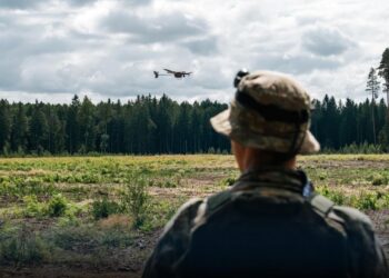
Therefore, Keilaf knew that defenders would have to see and not sense incoming drones. The challenge becomes more difficult when drones operate at low altitude, move through trees or buildings, or are launched from unexpected positions. In some scenarios, a drone could be deployed from inside a military base, bypassing sensors designed to monitor threats approaching from outside the perimeter.
That leaves defenders with only seconds to detect the aircraft, establish its trajectory, distinguish it from other objects, and activate an interceptor.
Keilaf believes its automotive LiDAR technology can help close that gap.
From autonomous driving to drone detection
LiDAR uses laser pulses to measure distances and create a three-dimensional representation of the surrounding environment. In autonomous vehicles, the technology helps identify roads, obstacles, and other vehicles. In military applications, the same capabilities can be used to locate and track small airborne targets.
Innoviz says its sensors provide precise three-dimensional positioning data, including the X, Y, and Z coordinates needed to calculate a target’s location and movement.
This information is particularly important for kinetic counter-drone systems. While cameras can identify objects, a weapon system also needs accurate range and position measurements to calculate an interception path.
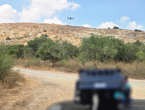
The company’s current high-resolution LiDAR operates at approximately 10 Hz, updating its measurements ten times per second. Innoviz says it has demonstrated the ability to detect a seven-inch drone without a payload at distances of several hundred metres.
The technology is designed to work in visually complex environments, including areas containing trees, buildings, and other obstacles. Innoviz says its laser-based sensing can partially penetrate foliage, allowing it to detect drones or personnel that would otherwise be obscured. The system can even track drones through trees, something that has thus far been considered difficult if not impossible.
One of Innoviz’s more interesting claims concerns sensor durability. The company says its LiDAR systems can maintain nearly full performance even when their external sensor windows are heavily covered with mud or debris.
According to Innoviz, this performance does not depend on AI software reconstructing missing image data. The company describes the capability as unique within the LiDAR industry, although the claim has not been independently verified.
For military users, resistance to mud and dirt could be particularly valuable. Sensors mounted on combat vehicles must continue operating in environments where dust, debris, and poor weather can interfere with optical equipment.
A smaller sensor for airborne applications
Innoviz is also developing a new generation of LiDAR hardware designed for use aboard drones. The new sensor weighs approximately 600 grams, making it considerably more suitable for airborne platforms where payload weight is a major constraint. The company says it is in discussions with a prime contractor about further reducing the sensor’s size and integrating a camera into a combined package. Further, they believe that kinetic defence is absolutely necessary for the future of drone targeting.
“The mindset was we will use another drone to chase it. If you are able to see the enemy drone in 1 kilometer, then yes, you can use another drone. That might find it in time. If an enemy drone appears below one kilometer, then the intercepting drone is irrelevant. The likelihood that it be able to meet it sufficiently on time is too low,” said Keilaf.
The smaller hardware also expands Innoviz’s potential market beyond fixed installations and ground vehicles. Lightweight LiDAR could be incorporated into unmanned aircraft that need to operate around obstacles, track objects, or collect detailed spatial information. This could allow kinetic defenses like turret guns and net shooters more time to target and fire.
The widespread use of fibre-optic drones has exposed weaknesses in systems that depend heavily on detecting radio transmissions. It has also increased interest in combining multiple sensing technologies to improve detection and tracking.
Innoviz is approaching this market with technology originally developed for demanding automotive applications, where sensors must operate reliably despite vibration, dirt, weather, and changing light conditions.
Its existing manufacturing operations and experience supplying major automotive customers could help the company meet the production requirements of defence contractors. However, adapting automotive hardware for military use also requires integration with weapons, command systems, and operational procedures.
For Innoviz, the defence opportunity is not necessarily about replacing radar or cameras. It is about providing accurate three-dimensional information that allows those systems, and the weapons connected to them, to respond more effectively to small, fast-moving threats.