From the earliest weeks of Russia’s invasion of Ukraine, Ukraine’s power plants have been pummeled by projectiles from its adversary. But missiles aren’t the only challenge facing Ukraine’s energy infrastructure.
High-voltage electrical substations that were still operating and transmitting power saw significant disruption from something else: GPS interference.
Russia’s effort to jam GPS signals in Ukraine has mainly been aimed at disrupting Ukraine military communications, but since Ukraine’s power grid – like many others across the world – is reliant on GPS, it was heavily impacted early in the war.
This case points to the broad – and underdiscussed – implications of GPS interference. Just three to five years ago, such activity was mainly limited to areas close to Russia. Now, analysts say that activity is growing, and spreading globally.
“It’s been getting [so much] worse over the last five years or so,” said Dana A. Goward, the founder and president of the Resilient Navigation and Timing Foundation.
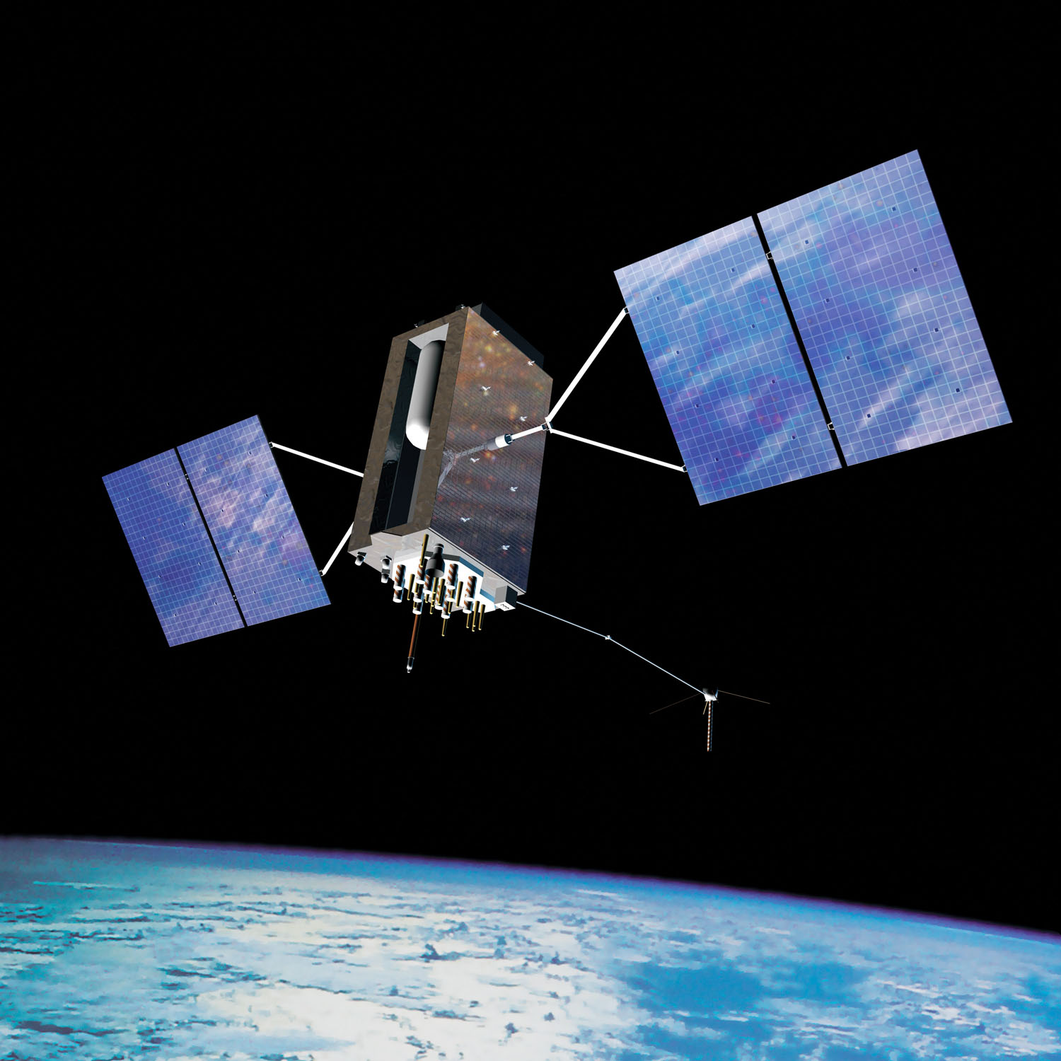
GPS – short for Global Positioning System, a satellite-based communications network owned and operated by the U.S. Department of Defence and used for geolocation and time information to any device equipped with a GPS receiver – may today be most commonly known for its commercial applications in consumer electronics like phones, watches, and vehicles, where it’s used for a wide range of location-based services.
But it is also critical in the defence domain, for example in missile guidance. Military vessels and installations often deploy jammers to disrupt such systems and make them more difficult to target with precision munitions. In addition to Ukraine, another hotspot for GPS interference is Myanmar.
Techniques a decade in the making
Russia has been jamming GPS for over a decade, but it has significantly increased its use in the last three years and become more sophisticated in its approach. Russia has constructed huge, specialist, ground-based jamming units around St Petersburg and Kaliningrad, where jamming signals are sent far out into the Baltic, said RUSI Associate Fellow Dr Thomas Withington.
Goward describes the strategy as “essentially low-level electronic warfare” against Russia’s neighbours.
And as Withington points out, the ubiquity of GPS usage means its impacts and potential targets are varied.
“Ostensibly this is about protecting military targets,” he said. “But the way they’re doing the jamming, it has secondary effects.”
Other sources of GPS interference are proliferating outside of warzones. For example, as more countries worry about drone incursions around critical infrastructure and military sites, interest and investment in anti-drone systems has surged. Many of these interfere with GPS and other Global Navigation Satellite Systems (GNSS) used for geolocation.
Interference is also used by criminals to stop their vehicles and vessels from being tracked.
The most obvious impact of GPS interference is on navigation. Last month, the GPSwise tool from SkAI Data Services detected over 20 planes flying above Europe suddenly reporting a false position over Peru.
What is GPS, anyway?
Though an irritant, GPS interference alone is not that serious a problem for aircraft or ships, whose crews are trained to use other methods as backups. That being said, analysts do caution that, if combined with bad weather, negligence or other factors, GPS interference could be followed by a collision or other incident.
Yet GPS interference, as the Ukraine example shows, also can have serious impacts on critical infrastructure – potentially outside of war. In countries across the world, GNSS’s are used for timing synchronisation within systems from the power grid to the stock market.
To understand why, it’s helpful to clarify what GPS is and how it works.
GPS is one of the world’s four major Global Navigation Satellite Systems. The others are China’s BeiDou, Europe’s Galileo, and Russia’s GLONASS. These are all constellations of satellites that broadcast a timing signal as radio waves. Triangulating signals from several satellites makes it possible to calculate the position too, hence they are a type of Position, Navigation and Timing (PNT) system.
GPS satellites operate at a high orbit, and the signal received on earth is very faint. There are two types of interference. The simplest is jamming, where ‘noise’ sent in the same frequency band as GPS drowns out the faint GPS signal, meaning the receiver cannot make it out.
The different frequencies used by the four GNSS’s are public information, said Dr Withington.
“To be a global navigation system, it’s imperative that everyone knows what they’re using,” he said.
Experts stressed to Resilience Media that jamming GPS is technologically very straightforward. It’s possible to buy small jammers on the internet, though they are illegal in many countries.
Much more sophisticated than jamming is spoofing, where a fake signal is broadcast. The receiver then uses this wrong information – as in the case of the planes over Europe reporting a position in Peru.
The emergence of software-defined radio has made spoofing much easier, meaning that “an experienced hobbyist” can now do what once only a sophisticated laboratory or nation-state could do, said Goward. Criminals and rogue actors have started to deploy this technology.
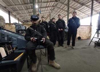
Dr Withington was speaking to Resilience Media from Ukraine, where GNSS interference is common. He noted that the tactics have shifted in the course of the war.
Russia “used to jam things through sheer power, using as much noise as possible,” he said, whereas now they have shifted to the more sophisticated technique of spoofing. In this case, “the receiver starts presenting that false information to the user,” he continued. “If it’s done in a very subtle way, you don’t really realise what’s happening.”
Along with ground-based and ship-based jammers, a recent paper documented the cases of space-based interference in recent years which, comparatively fewer, seem to be on the increase.
Critical infrastructure typically depends on GPS not primarily for positioning, but for precise timing. In a large system, there will be slight variations in the time measured on different devices. The GPS signal provides a comparatively cheap way to synchronise it. The obvious alternative – atomic clocks – would be prohibitively expensive.
In the case of the power grid, a device called a Phasor Measurement Unit (PMU) provides operators with detailed information about the voltage or current at a specific point. This is used to monitor and predict stress and stability within the grid. The data has to be precisely time-stamped to give an accurate picture of the overall power system. Without GPS, operators have reduced awareness of the state of the grid and struggle to diagnose issues or balance supply and demand.
Special vulnerabilities in Taiwan
One country vulnerable to power grid interference is Taiwan.
GPS jamming over a period of several hours or days “[would] cause the system to degrade,” said Holmes Liao, a former distinguished adjunct lecturer at Taiwan’s War College. This “places the grid in a state of extremely high risk,” he continued. “If a fault or severe weather occurs during this time, the lack of observational capability could lead to a blackout that was otherwise avoidable.”
Liao said that the “easiest way” to interfere with Taiwan‘s GPS would be from the sea.
“Suppose China deploys a few ships disguised as cargo or fishing ships and they start blasting radio frequency signals at the same frequency as GPS towards the island,” he said. “That will block out all the GPS receivers and make them unable to decipher the GPS signals from space.”
Depending on the exact scenario, China would presumably want to avoid jamming its own GNSS – BeiDou – at the same time. This would probably be technically possible but is still challenging, said Dr Withington. “It would require Chinese jamming to have enough precision to avoid the frequencies used by BeiDou.”
The impact of GPS jamming would be felt in several pieces of key infrastructure.
Computer and mobile phone networks rely on the timing signal provided by GPS. High-frequency trading (HFT) in the Taiwanese stock market – which is time stamped with GPS – would not be possible, though financial experts note that HFT was only introduced in 2020 and the loss would not be that destructive.
The Taiwanese government has been slow to recognise this vulnerability, which is not generally mentioned within “whole of society resilience” efforts.
Taiwan’s Ministry of Digital Affairs and the Bureau of Energy within the Ministry of Economic Affairs did not respond to requests for comment.
Unlike Russia, China has rarely engaged in GNSS interference. Liao argues that this is because “China does not need to alert Taiwan. They do not need to forewarn the Taiwanese government.”
“The Taiwanese government needs to catch up,” Liao continued. “If they are unaware of the risk and do not have any mitigation, there is a grave risk of Taiwan’s society being brought to its knees by China’s jamming.” He argues that the government needs to do a comprehensive assessment of critical infrastructure’s vulnerability to jamming, and adopt an alternative as a backup.
So what are the alternatives to GPS?
Аlternatives exist, but they may be complex to implement. “There’s not a silver bullet… There’s not one single technology that will make GNSS jamming not a problem,” said Dr Withington. But, he added, “There are several technologies that, if used together, could reduce the severity.”
For military systems, various technologies such as inertial navigation offer possible alternatives to GPS for navigation.
In the case of Ukraine’s power grid, a group led by a Cisco Talos cybersecurity researcher found a technical stop-gap. They installed Industrial Ethernet switches, which have a sufficiently accurate clock to sustain a time sync, to use in periods of GPS outages.
Critical infrastructure more broadly should have at least one alternative for precise timing.
The ideal, said Goward, is the ‘Resilience Triad’ of PNT signals from three sources: space, terrestrial broadcast, and fibre cables. In the case of grid infrastructure, connecting all substations with fibre might be prohibitively expensive, but terrestrial broadcast is still certainly feasible as a backup.
Liao highlights eLORAN, a ground-based PNT, as a potential backup for Taiwan’s critical infrastructure. It is high-power and low-frequency, and thus extremely difficult to jam. Given the long range of these signals, transmitters could be deployed to the Philippine or Okinawa, allowing triangulation and therefore resilient position accuracy even in the case of a cross-Strait contingency.
South Korea, which faces relentless GNSS interference from its neighbour, uses this system; in November, the UK government invested £71 million in an eLORAN programme.
China has taken this problem seriously. BeiDou, the country’s counterpart to GPS, is similarly vulnerable to interference. The country has built its own eLORAN system “to ensure that denial of space is not a problem,” explained Goward,. It is also developing a low Earth orbit (LEO) PNT constellation and strengthening fibre connections, meaning that infrastructure will have several different potential sources of timing if needed.
The US, in contrast, shut down its previous LORAN system in 2010, though it is now conducting some experiments with eLORAN. For the time being, said Goward, “we don’t have a system to back up GPS.”
Ultimately, this is a solvable problem, and there are grounds for optimism.
Reducing dependence on GPS and having alternatives available “shouldn’t be that difficult,” said Dr Withington. “We’ve only relied on GPS for 30 years in mass [general use]. That shows there is a way around this.”